
Floodplain Management
The City of Springfield participates in the National Flood Insurance Program (NFIP), run by the Federal Emergency Management Agency (FEMA). The objectives of the NFIP are to (1) ensure that new buildings will be free from flood damage, (2) prevent new development from increasing flood damages on existing properties, and (3) ensure the natural and beneficial functions of the floodplain are maintained. NFIP was created by the U.S. Congress in 1968 to help minimize the costs of disaster relief and reduce the loss of life and property caused by flooding. Participation in the NFIP allows community members to buy federally backed flood insurance, which is required for federally backed loans to purchase or build structures located in a floodplain. NFIP participation also ensures the City remains eligible for federal disaster assistance in identified floodplain areas.
Floodplain management involves several aspects, each described in more detail below:
1 – Maps showing areas where flooding may occur.
2 – Regulations that promote health, safety, and general welfare, and minimize loss due to flooding.
3 – Floodplain Permits for development proposals.
4 – Flood Preparedness includes links to resources to prepare for a flood.
Maps
Map Updates
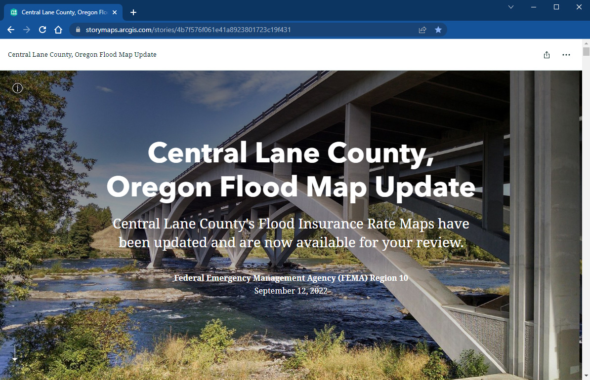
FEMA has updated flood maps to better show the risk of flooding in Central Lane County. These Frequently Asked Questions provide basic information about the map updates. Use this comparison tool to compare the existing flood map (effective) with the updated flood map.
To learn more about the updates, please check out FEMA’s story map. Through this virtual resource, property owners and community residents can learn about the flood mapping process and what the changes mean for them. They can also get information about the National Flood Insurance Program. Residents can learn who to contact if they need more support. We encourage you to visit the virtual resource, review your flood risk, and ask questions via the contact information it provides. You can also ask for a flood map for your property by emailing PropertyIDMap@starr-team.com.
Información en español
Actualización del mapa de tasas de seguros contra inundaciones
Contacto: Molly Markarian at 541.726.4611 or mmarkarian@springfield-or.gov.
Adopted Maps
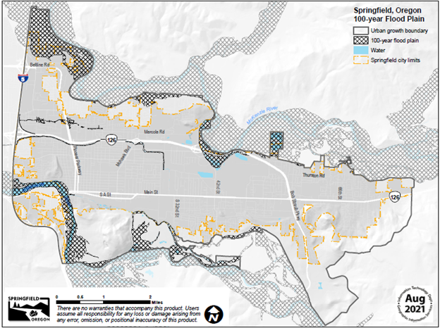
The map below shows the 100-year floodplain which is currently the area of special flood hazard that is included in the Floodplain Overlay District.
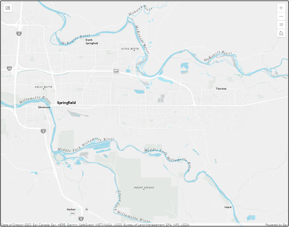
Interactive Map
This mapping tool allows you to look up a property by address or assessor’s map and tax lot to determine if it is currently within the Floodplain Overlay District.
Regulations – Floodplain Overlay District
Participation in the NFIP requires the City to adopt and enforce floodplain management regulations for development within areas of special flood hazard. The areas of special flood hazard are adopted as the Floodplain Overlay District. These regulations are included in Chapter 3, Section 3.3-400, in the Springfield Development Code.
To meet current minimum standards for continued participation in the NFIP, the City Council and Board of County Commissioners co-adopted code amendments on January 3, 2022, and February 8, 2022, respectively. The City’s adopting ordinance includes some background information on the floodplain management program.
A floodplain development permit is required for all development within the Floodplain Overlay District which includes all the special flood hazard areas (those within the 100-year floodplain).
Any new development such as a fill or excavation, all structures including a small shed requires a floodplain development permit. The permit is required for all structures including manufactured dwellings and all other developments. Floodplain development permits, like most other City permits, are issued at the Development Center.
A floodplain development permit is required for all development within the Floodplain Overlay District which includes all the special flood hazard areas (those within the 100-year floodplain). Any new development such as a fill or excavation, all structures including a small shed, and the placement of manufactured dwellings, require a floodplain development permit. In limited circumstances, it may be possible to obtain a variance to floodplain regulations if the regulations would cause exceptional hardship. Floodplain development permits, like most other City permits, are issued at the Development Center.
Floodplain development application can be found at: Floodplain Development Permit Application
A floodplain variance application can be found at: Floodplain Variance Application
Fee Schedule for Floodplain Development Permits can be found at: Development Code Application Fee
For more information about applying for a floodplain permit, please call the planner on duty at 541-726-3753.
How to prepare for an emergency: Springfield Emergency Management
How to Prepare for a Flood: Lane County Flood Preparedness
How to Prepare for a Disaster: Example of a Preparedness Kit from Lane County
How to Reduce Flood Risk: Reduce Flood Risk
Other Resources
Floodplain Open House Presentation – 10/20/2022
FEMA Website
Official NFIP Website
NFIP in Oregon Webpage
